 A few blocks away from this Westville creek, houses are sinking and no one knows why. Neighbors Monday questioned whether a nearby Whalley Avenue expansion project requiring altered drainage would further affect their flood-prone, cracking homes. And they called out for help.
The house-sinking victims live on a cozy grid of streets in Westville’s Beverly Hills area. On and near Beverly and Westerleigh Roads and Greenhill and Greenview Terraces, trim Cape-Cod style homes are slowly growing askew. Since summer 2004, residents have noticed cracks forming, rain prompting bigger and bigger floods, and garages taking on new slants.
A couple of years and a couple of engineering reports later, residents still haven’t found out why. At a public hearing Monday, they wanted to make sure the state Department of Transportation wasn’t going to add to the problem. And they called out to the DOT for help.
The Traffic-Easing Plan
The state wants to expand Whalley Avenue in the Amity corridor, where cars zoom off the Merritt Parkway and sometimes collide in confusion, driving two abreast in a single lane as Whalley heads towards New Haven. From Rt. 69 to Emerson Street, the eastbound lane of Whalley would be widened to two lanes.
The jagged connection between Ramsdell and East Ramsdell Streets would be smoothed out, creating a single intersection across Whalley. The expansion would reduce accidents and enable the street to bear its already heavy load: 25,000 vehicles per day. Construction would begin next spring.
The DOT plans require drainage pipes and culverts that feed into the West River to be widened and altered. They also encroach on the nearby waterway, extending a culvert over it and eating up a sliver —” .044 acres —” of wetlands, according to the DOT. Before the plans go through, the state Department of Environmental Protection needs to issue a permit.
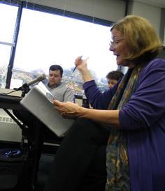
 The matter was going to fly through unchallenged before neighbors petitioned for a public hearing Monday. With a walking tour and an open Q & A session, the DOT and DEP made the case that the project would have no impact on residents’ mysterious sinking problems. The tour, led by DOT wetlands-assesser Kimberly Lesay (pictured at left), touched on areas of wetlands impact. Tour leaders didn’t bother to scope out neighbors’ backyards because “[The plans] shouldn’t have any impacts on people’s homes,” said Craig Babowicz, a DOT engineer.
Sharon Yurasevecz, a DEP engineer, later backed him up: There would be “no adverse flooding effects” caused by the project. She had no objections to the wetlands permit. The neighbors’ plight is “not really relevant” to the study she undertook to analyze the impact, she said, because the drainage system is closed and would not affect groundwater.
Are you sure?
A dozen or so residents, lead by State Rep. Pat Dillon and State Sen. Toni Harp, wanted to be sure. “We need to be reassured whatever happens does not further destabilize the neighborhood,” said Melanie Stengel, who lives on Beverly Road.
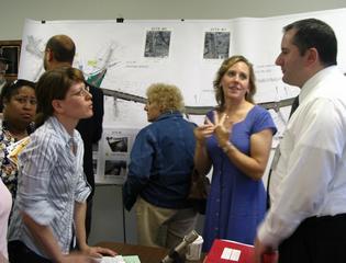 Are you sure those drainage pipes won’t back up into our system? asked Rachael Vaters-Carr (pictured at left), a Westerleigh Road resident who, three months after remodeling a bathroom, saw cracks forming between the fresh tiles. Will the water table drop more?
“When you’re losing your home, there’s an intense desire to hold every government agency up to the highest scrutiny,” said Dillon.
A first study commissioned by the city concluded buildings were sinking because they had been built on an old ice pond that was filled in in 1937. The study reasoned when the water table recently dropped, some pockets of peat became dry and gave out under the weight of houses.
Dillon and Harp procured state funds to have the Connecticut Academy of Science and Engineering take a second look. That group’s initial report, which has not been officially released, said the ice-pond hypothesis “doesn’t fit the facts” because some houses were not built in the footprint of that pond, said Dillon. Dillon said she and Harp are hoping for $200,000 from a state contingency fund to finance phase 2 of the study, which would venture where previous studies did not —” into the sinking homes.
 By the end of the two-hour hearing, a two-fold purpose became clear. Neighbors weren’t just trying to scrutinize DOT plans, they were calling out to the DOT, the DEP, anyone, for help.
Dillon (pictured) asked the DEP for help procuring pre-1940 maps that might reveal where underwater waterways are. A DEP rep complied. Dillon has also tried to get loans and grants for the suffering home-owners, but that plan is on hold until the mystery of the unbalanced homes is solved.
Meanwhile, DEP hearing officer Jean Dellamarggio is leaving the record open until June 20 for anyone to submit additional testimony. After that, she’ll make a decision on the wetlands permit.


Great reporting. The map is really helpful.
However, to say Toni Harp and I 'led' the group doesn't give homeowners enough credit. DOT tried to waive a public hearing, and Beverly Hills families carried petitions to get this hearing. It is true that Sen. Harp and I attended the full hearing to get the facts and support our neighbors, but they led the way.